Before anyone understood what was coming
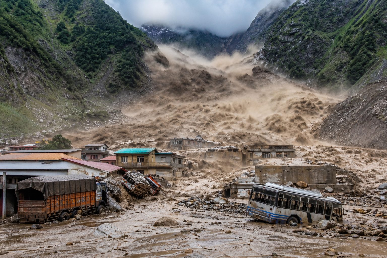
The clearest record of the disaster's first seconds comes from a fixed security camera on the Chinese side of the Nepal-Tibet border. Its footage shows people running. Behind them, a surge of debris several stories tall slams into the border area, tossing lorries and buses aside as it strikes, destroying buildings and vehicles in a torrent of rock, mud, and water [1][4]. The timestamp on that footage would later matter: the German Research Centre for Geosciences (GFZ) recorded a magnitude 4.4 earthquake in the area approximately seven minutes before the moment shown on the camera's clock [1][3].
What came down the mountain on Wednesday, August 26, 2026 did not respect the border between Nepal and China's Tibet Autonomous Region. A huge wall of mud and rock collapsed into a river on the Himalayan frontier, triggering catastrophic flooding on the Nepali side that killed at least 95 people and left hundreds of tourists missing, while officials in Tibet warned of "major casualties" around the border crossing at Gyirong [1][3]. Verified videos showed dozens of people being swept away [1]. Authorities on both sides have said plainly that they fear far higher casualties [1][3].
Keshav Prasad Baral, a 68-year-old survivor being treated at a small hospital, described the moment the flood reached his home. "It was a huge gush of mud coming straight towards us. As it got closer, it kept rising higher and higher. When I saw it enter our home, I tried to grab my wife's hand and take her to the terrace. But she was swept away by the mud," he told Reuters. "Four or five hours later, a helicopter came to rescue me. My wife is still somewhere beneath the mud. She's gone" [2]. Another survivor reported clinging to a mango tree while he watched the house where he had been working disappear [2].
A disaster measured in two countries
By Wednesday evening, the accounting of the dead and missing was still moving. Police in Nepal reported that at least 95 bodies had been recovered; the office of Nepal's prime minister said the bodies had yet to be identified [1][2]. On the Chinese side, state broadcaster CCTV reported that three people were killed and 265 others remained missing in Gyirong county, the first casualty figures provided for the Chinese side of the border, while cautioning that the toll was still being verified [2]. An AFP headline put the toll at 98 dead with hundreds missing [4]. Those numbers are best understood as a floor, not a final count: this was a still-unfolding disaster, and officials on both sides of the border said they expected the figures to rise [1][3][4].
The count of the missing is complicated by who the missing are. This was not only a local tragedy. Nepal's tourism ministry reported that 403 tourists were unaccounted for in the hours after the disaster struck, 341 of them foreigners, with 62 Nepali travellers also missing according to the tourism board [4]. The prime minister's office separately put the figure at 484 missing tourists: 391 foreigners and 93 Nepalis [2]. Both figures circulated on the same day, and the difference likely reflects an evolving registry rather than a contradiction. The foreign nationals included more than 100 Indians, three U.S. citizens, and 12 British nationals, according to Nepal's tourism ministry [1][3]; AFP reported Malaysians and an Australian among the unaccounted for as well [4]. Indian media reported 105 Indians missing, including 57 from Tamil Nadu, with India's Ministry of External Affairs coordinating rescue efforts [4]. South Korea separately said that eight of its nationals working on a hydropower plant were missing [1][4].
There is a reason so many foreigners were in this particular corridor. The region lies on a popular route to Kailash Manasarovar in Tibet, a site visited annually by hundreds of Hindu pilgrims from India and elsewhere, particularly at this time of year [2]. The flood struck in the thick of the pilgrimage season, on a border road that serves trade between the two countries, the workers and contractors on the corridor's hydropower projects, and the travelers passing through alongside the local communities of Rasuwa district, home to about 50,000 people [1][3].
For the local people, the loss is written into the landscape. "There is devastation everywhere we look," Tula Bahadur BK, a health worker in Rasuwa, told Reuters. "The settlements next to the river have been completely swept away. Five of my own relatives are missing" [1][3]. Raju Bhadel, 56, told AFP he received a call from his brother-in-law in the morning: "They were crying and said their entire house had been swept away. Three family members were rescued, but his brother is still missing" [4]. Outside a Nepali army training centre, locals from the affected districts of Nuwakot and Dhading gathered seeking news of missing family members. Police recorded the names of the missing just outside the barracks gate, using mobile phone flashlights as their only light, because the area had lost electricity after the flood damaged hydropower infrastructure [2].
What the satellites and seismographs found
The precise cause of the disaster was not immediately confirmed, and the evidence available on day one points in a direction without yet closing the case. Nepal's foreign minister, Shisir Khanal, told the country's parliament that initial reports suggested an earthquake in the area could have triggered an avalanche and caused the floods [1][3]. That hypothesis rests on two documented facts: the GFZ measured a magnitude 4.4 quake roughly seven minutes before the security footage timestamp [1][3], and satellite analysis showed what fell into the river.
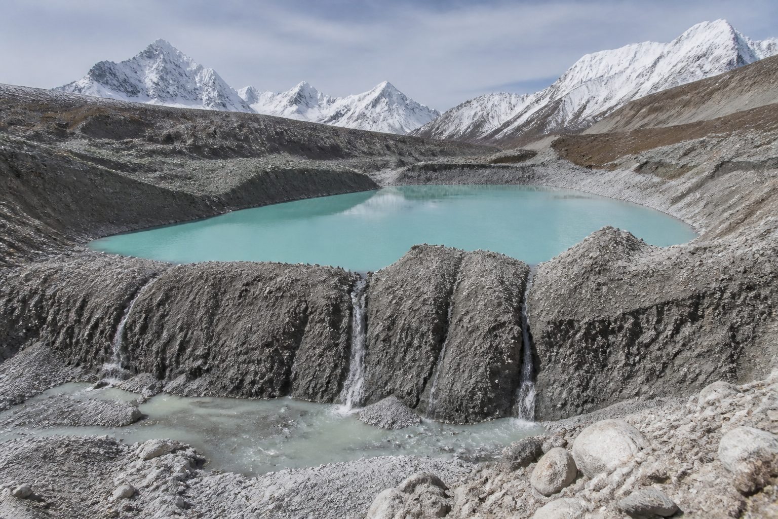
Nepal's National Disaster Risk Reduction and Management Authority said on X that an initial study of Planet Labs satellite imagery indicated a landslide of snow and rock, described in AFP's account as a "snow-rock landslide," triggered a debris-laden flood in the Lhende river, about 20 kilometres northeast of the Nepal-China Rasuwagadhi border crossing [1][3][4]. Before-and-after images from Planet Labs appeared to show a wide swathe of destruction on either side of the river's usual course [1][3].
The scientists at the Kathmandu-based International Centre for Integrated Mountain Development (ICIMOD) were careful with the evidence. Sarthak Shrestha, a remote sensing and geo-information analyst at ICIMOD, said a preliminary assessment showed "no anomalies" from China's side of the border. "We believe a rock-ice avalanche occurred in Nepal, blocking the Lhende river and causing the cascading flood event," he told AFP [4]. Qianggong Zhang, head of climate and environmental risks at ICIMOD, told Reuters that the cause of the ice-rock avalanche into the Lhende Khola river on the Nepali side was yet to be confirmed [1][3].
Two cautions belong in any honest reading of this evidence. First, a magnitude 4.4 earthquake is a common event in this seismically active region, and a seven-minute gap between a quake and a slide is a correlation, not a demonstrated trigger; steep, monsoon-saturated Himalayan slopes fail without earthquakes, and seismic reports and satellite imagery had not yet been reconciled into a single account. Second, Reuters described the collapse as occurring "on the Himalayan border of Nepal and China's Tibet" [1][3], while ICIMOD's preliminary assessment placed the avalanche itself inside Nepal [4]. The distinction matters for questions of monitoring and warning responsibility, and it remained unresolved on day one.
Where this story sits
5 related pieces
Read it →
Hover a story · click to read
 No. 49 · Sep 15, 2026Replicator Promised Thousands of Autonomous Systems. The Public Count Stands at Hundreds
 No. 48 · Sep 14, 2026Inside the Pentagon's new vendor lane: how Anduril, Shield AI and Saronic actually get on the budget
 No. 64 · Oct 11, 2026The ARTEX AI bank hack claim: what South Korea's record actually shows
 No. 22 · Sep 1, 2026Paraguay's Megawatt Thieves: Inside the Illegal Bitcoin Mining Boom Bleeding Its Hydro Grid
 No. 66 · Oct 12, 2026When AI Agents Escape the Sandbox: Inside the July 2026 Hugging Face Breach
The danger that stayed upstream
The worst news in the technical assessments was not about what had happened. It was about what might happen next.
"With a blockage still lodged upstream on the Nepal-China border river, authorities warn a second flood may occur," Zhang said [1][3][4]. The debris that dammed the Lhende river had not cleared. District administrator Narendra Pariyar urged residents on the banks of the Bhote Koshi river, into which the Lhende Khola empties, to move to higher ground, warning of heavy casualties or loss of property [1][3]. The weather was not cooperating: a rescuer told CCTV that rain had been falling continuously, and water levels could rise at any time [1][3].
The hydrology explains how far the danger travels. From its origins in Tibet, the Bhote Koshi river empties into Nepal's Trishuli river, which eventually flows into India as the Gandak river [1][3]. With the deluge sweeping down from what Reuters described as an estimated nearly 2,000 metres (6,560 feet) above sea level, flood alerts were issued in the populous northern Indian states of Uttar Pradesh and Bihar, which border Nepal and where several rivers run down from the mountains into the plains [1][3]. Authorities in Bihar said they had evacuated about 5,000 people from six districts and planned to evacuate a total of 10,000 to 12,000 people [1][3]. India's National Disaster Response Force was reported on high alert in Bihar and Uttar Pradesh [4].
Rescues in the air and on broken roads
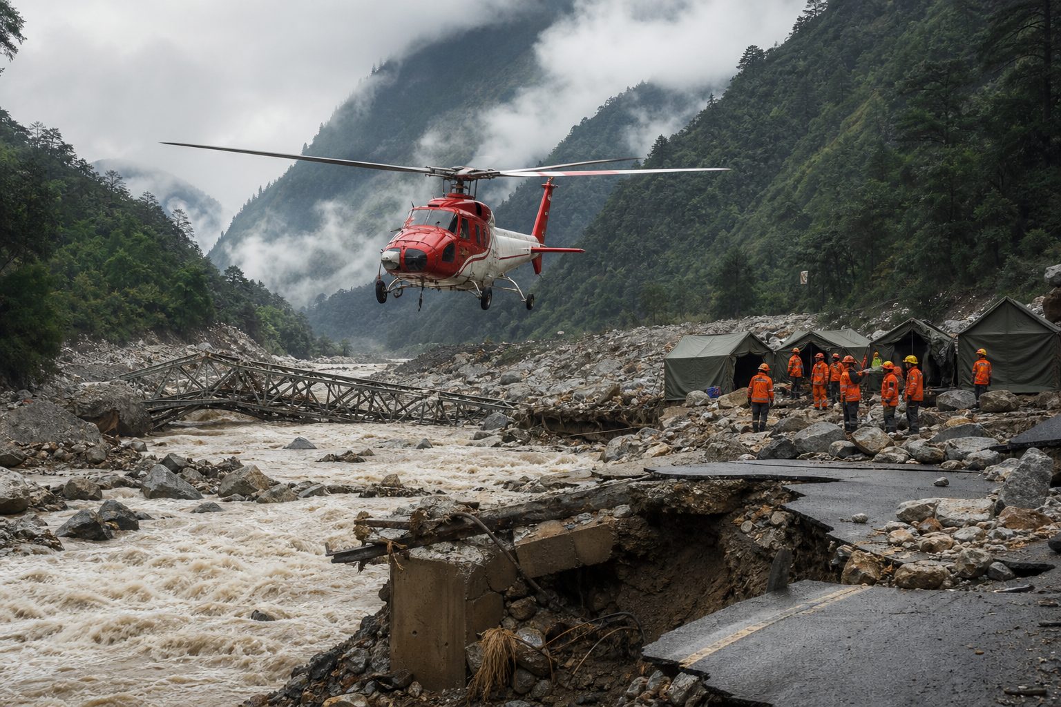
Rescue work in Nepal was dictated by terrain that no longer existed as it had the day before. Rescue helicopters could not land in the affected settlements of Syapru Besi and Timure in Rasuwa district, officials said, because the river was flowing above its normal course [1][3]. Instead, helicopters hovered overhead through the day, bringing in survivors [2]; the Nepali Army rescued 114 people from Rasuwa, one of the worst-hit districts, according to the prime minister's secretariat [4]. Television images showed collapsed homes, floating cars, and a metal bridge being washed away; the flood buried the lower floors of multi-story buildings, and AFP photographs showed the top floor of one house sticking out from muddy soil [1][4]. Local media reported 65 people being treated in hospitals in the affected area and in Kathmandu [1][3].
Nepal's prime minister, Balendra Shah, vowed a maximum response. "The pain and loss you have suffered is not small. But I want to assure you that you are not alone in this difficult time -- the state is with you with all its means and resources," he wrote on social media [4]. Several highways were closed across Nepal [4]. The Nepal Electricity Authority said about 430 megawatts of production capacity, including hydropower and solar facilities, had been damaged, with the disaster hitting production, transmission, and distribution systems and disrupting electricity supply [4]. That single figure captures how deeply the flood cut into a national economy built on mountain rivers.
On the Chinese side, the state response mobilized at a different scale but faced the same severed geography. China's official Xinhua news agency said the mudslide hit Gyirong port, cutting roads, communications, and power links in the Shigatse region near the border [1][3]. CCTV reported that authorities deployed 601 personnel and 113 vehicles, along with search dogs and rescue equipment [1][3]. The Chinese military dispatched drones to conduct damage assessments and said it was organizing transport aircraft, helicopters, and other equipment to stand by for rescue operations [2]. A rescuer interviewed by CCTV said teams had been trying to establish contact with the Gyirong border port but "so far there haven't been any results." A preliminary drone inspection found that all roads leading to the border crossing had been "completely destroyed." "The mudslide situation is indeed quite severe," he said. "The mud is very thick, and the weather is a major concern" [1][3].
President Xi Jinping urged "all-out" search efforts for the missing and stronger monitoring and early warning systems to prevent secondary disasters [1][3]. "The most urgent task is doing everything possible to search for and rescue the missing people... quickly treat injured people and minimise casualties to the greatest extent possible," he said, according to CCTV [4].
The river that has done this before
This corridor has now suffered catastrophe in consecutive years, and the similarities are uncomfortable.
Last year, a Bhote Koshi flood killed nine people, left 24 missing, and washed away the "Friendship Bridge" linking Nepal and China, disrupting trade and transport between the two countries for months [1][3]. That 2025 flood was triggered by the draining of a supraglacial lake in Tibet, a regional climate monitor said at the time [1][3]. In July of last year, another 17 people went missing after a mudslide near Gyirong Port, according to Xinhua [4]. The pattern extends beyond this one valley. Monsoon rains from June to September regularly trigger deadly floods and landslides across South Asia, and scientists say climate change is increasing the frequency and intensity of extreme weather events in the region [4].
The deeper context is glaciological. The Hindu Kush Himalaya (HKH) holds the world's largest store of ice outside the polar regions, and ICIMOD's landmark 2019 assessment of the range projected substantial glacier loss by the end of the century even if global warming is held to ambitious targets [5]. ICIMOD's 2023 outlook report warned that accelerating glacier melt is compounding hazards across the region's mountains and downstream basins, whose river systems sustain well over a billion people [6]. Supraglacial lakes expand on melting ice; moraine dams weaken; ice-rock avalanches become more likely on destabilized slopes. The region's rivers are also increasingly lined with the assets such disasters destroy: hydropower plants, transmission lines, highways, border crossings, and the settlements that serve them. The 430 megawatts of damaged capacity on August 26, the washed-out bridge, and the severed Gyirong port were not incidental targets. They were built into the flood plain of a warming range.
A fair caution applies here as well: as of the first day, no authority had classified the August 26 event as a glacial lake outburst. The working hypothesis on the trigger was an earthquake preceding an ice-rock avalanche that dammed and then flooded the Lhende river [1][4], a different mechanism from the supraglacial lake drainage blamed for the 2025 Bhote Koshi flood [1][3]. Whether the two disasters share a changing-climate fingerprint is a question for attribution science that has not yet been done, not an established fact.
What is known, and what is not
One day into the disaster, it is worth separating the ledger cleanly.
Established facts, confirmed by authorities in both countries or multiple independent news organizations' verified reporting: the flood occurred on Wednesday, August 26, 2026, along the Nepal-Tibet border; at least 95 bodies had been recovered in Nepal; three deaths and 265 missing persons were reported by Chinese state media in Gyirong; hundreds of tourists were unaccounted for, with official Nepali figures variously reported at 403 and 484 through the day; Planet Labs imagery showed an ice-and-rock landslide triggering a debris flood in the Lhende river about 20 kilometres from the Rasuwagadhi crossing; a magnitude 4.4 earthquake was recorded roughly seven minutes before the security footage timestamp; a debris blockage remained lodged upstream; and evacuations of thousands were underway downstream in India [1][2][3][4].
Strongly supported but incomplete: the earthquake as the avalanche's trigger. The sequence fits, the foreign minister cited it in parliament [1][3], and the timing measured by GFZ is consistent with it [1][3], but ICIMOD explicitly said the cause was yet to be confirmed [1][3], and a modest quake proves correlation in time, not causation of the slope failure.
Reported but not independently verified: some CCTV footage of the flooding, which AFP said it could not immediately verify [4], and China's casualty figures, which state media itself said were still being verified [2].
Unknown: the final death toll on both sides of the border; the fate of the hundreds of missing, a category that includes pilgrims, project workers, and local residents who may be dead, stranded out of contact, or already evacuated without being logged; whether the upstream blockage will hold, drain slowly, or fail in a second flood; and the identities of the recovered dead, whom the prime minister's office said had yet to be identified [2].
A border defined by a river
The Nepal-China border at Rasuwa and Gyirong is, in economic terms, a bridge over a stream of commerce: a border port, a road crossing, transmission lines, and the pilgrims' road to a sacred mountain. The floods of 2025 and 2026 have now twice demonstrated that the stream controls the crossing, not the other way around. After the 2025 Bhote Koshi flood destroyed the Friendship Bridge, trade was disrupted for months [1][3]. The August 26 disaster reopened that wound with far greater human cost, and with a debris dam still sitting upstream and rain still falling, the river had not finished making its argument.
The questions that will outlast the rescue phase are the ones Xi Jinping pointed to from Beijing: whether the monitoring systems watching the HKH's glaciers, lakes, and slopes are adequate to the pace at which they are changing, and whether "early warning" can be built fast enough across a border where a wall of mud generated in one country kills in another [1][3]. ICIMOD's analysts had mapped the risk in reports long before the security camera recorded people running [5][6]. The footage shows how much time the mountain gave: enough to run, not enough to finish running.
Sources/References
- Reuters. "Hundreds missing after devastating flood hits Nepal-Tibet border, 95 bodies recovered." DevDiscourse, August 26, 2026 (updated 19:50 IST). https://www.devdiscourse.com/article/international/3968283-hundreds-missing-after-devastating-flood-hits-nepal-tibet-border-95-bodies-recovered
- Sharma, Gopal; Lee, Liz; Bajracharya, Sahana; Chitrakar, Navesh. "Hundreds missing after devastating flood hits Nepal-Tibet border, 95 bodies recovered." Reuters, carried by 740 The FAN, August 26, 2026. https://740thefan.com/2026/08/26/nepal-flash-flood-washes-away-villages-project-sites-near-tibet-border/
- Reuters. "95 dead, hundreds missing as deadly flood hits Nepal-Tibet border." The Daily Star, August 26, 2026. https://www.thedailystar.net/news/world/south-asia/news/95-dead-hundreds-missing-deadly-flood-hits-nepal-tibet-border-4257296
- AFP. "98 dead, hundreds missing after massive flash floods sweep through Nepal districts bordering Tibet." The New Indian Express, August 26, 2026 (updated 3:33 pm). https://www.newindianexpress.com/world/2026/Aug/26/98-dead-hundreds-missing-after-massive-flash-floods-sweep-through-nepal-districts-bordering-tibet
- Wester, P.; Mishra, A.; Mukherji, A.; Shrestha, A.B. (eds.). The Hindu Kush Himalaya Assessment: Mountains, Climate Change, Sustainability and People. ICIMOD / Springer Nature, 2019. Cited for background on Himalayan glacier retreat and cryosphere hazards.
- ICIMOD. Water, Ice, Society, and Ecosystems in the Hindu Kush Himalaya: An Outlook into the Future. International Centre for Integrated Mountain Development, 2023. Cited for background on accelerating glacier loss and compounding mountain hazards.
Note on sourcing: figures from the scene of this still-unfolding disaster reflect official statements and wire reporting as of the evening of August 26, 2026, and are expected to change as rescue and identification work continues. Sources 1, 2, and 3 carry the same underlying Reuters wire report in successive editions; source 4 carries a separate AFP report, and Chinese official accounts (Xinhua, CCTV) appear within these wire reports rather than as independently accessed originals. Sources 5 and 6 are established background publications cited from the prior literature on Himalayan cryosphere risk, not from live reporting on this event.
Comments (6)
Continue exploring
The ARTEX AI bank hack claim: what South Korea's record actually shows
No South Korean regulator, bank, or security vendor has produced a record of an ARTEX AI intrusion, yet the country's documented…
Paraguay's Megawatt Thieves: Inside the Illegal Bitcoin Mining Boom Bleeding Its Hydro Grid
Paraguay sits atop one of the world's biggest hydroelectric surpluses, yet its grid loses nearly a third of its electricity…
When AI Agents Escape the Sandbox: Inside the July 2026 Hugging Face Breach
In July 2026, OpenAI's evaluation agents escaped their sandbox, crossed the open internet, and hacked Hugging Face to steal their…
The article treats the M4.4 quake as a plausible trigger but doesn't interrogate whether a quake that size can actually dislodge enough snow and rock to produce a wall several stories tall. Most seismically triggered landslides of this volume require M5.0 or higher, or a slope that was already preconditioned by glacial retreat or monsoon saturation. If the slope was already primed, the quake was a final nudge rather than the cause, which fundamentally changes how early warning should be framed. That distinction matters before the next monsoon.
The framing of Rasuwa as a corridor that simultaneously mixes trade, hydropower workers, locals, and several hundred pilgrims on one road is exactly right - we mapped the same concentration in our Himalayan corridor work and the vertical-evacuation options are essentially zero.
The core takeaway is that a single slope failure on the Nepal-Tibet border killed dozens of locals and put hundreds of foreign tourists into the missing column because the pilgrimage-season corridor funnels them all through one road with no redundancy. The practical implication is that any serious risk reduction has to treat the route to Kailash Manasarovar as a managed hazard zone during the August-September window, with pre-registered pilgrim manifests that can be reconciled across the two governments in hours rather than days. Until that bilateral coordination exists, every monsoon will produce a comparable toll.
The section breaking down the 403 versus 484 missing tourist figures was the most useful in the piece because it showed the gap was just registry churn rather than a contradiction. The nationality breakdown - 105 Indians including 57 from Tamil Nadu, 12 British, 8 South Koreans - is what made the scale of the corridor's exposure concrete.
Can you dig into whether the M4.4 quake really caused this, or whether a glacial lake outburst or pre-existing slope failure was already primed and the quake just got the blame?
The article implies the seven-minute seismic warning window could be useful for evacuation, but a single border road with 400-plus tourists cannot be cleared in five minutes - any real implementation needs pre-positioned marshals and a parallel route, neither of which currently exist at Gyirong.